Hāʻena State Park & Kalalau Trail Permits: Complete Hanakapiʻai Falls Hiking Guide

Updated: Jul 14

Hanakapiʻai Beach and Hanakapiʻai Falls
Eight miles. Sea level. Jungle, river crossings, black sand, and a 300-foot waterfall at the end of a valley most people will never reach. Here’s everything you need to know before you go.
Why Hāʻena
There are places you see and places you move through. Hāʻena State Park is the second kind.
The Kalalau Trail begins at Keʾe Beach at the very end of Kauai’s North Shore highway — literally the last place the road goes — and from the first quarter mile it asks something of you. Not in a punishing way. In the way that real places do. The kind of trail that requires your full presence and gives back something you cannot get from a lookout point, a helicopter tour, or a postcard.
I hiked the full 8-mile round trip to Hanakapiʻai Falls on my April 2026 Kauai trip. Through the coastal cliffs, down to the black sand beach, inland through the jungle valley, stream crossings and all. What I found at the end was worth every one of those miles. What I found along the way was worth more.
This is the guide I wish I had before I went.
Before You Go: The Permit Situation
This is the most important section in this entire guide. Read it before anything else.
Both a parking permit and a trail permit are required to access Hāʻena State Park and the Kalalau Trail. Permits must be booked in advance at gohaena.com. They open 30 days in advance and sell out within hours — sometimes minutes — for weekends and peak season dates.
There are no walk-ins. No exceptions. Rangers enforce this at the trailhead.
Book your permits before you book your flights. Decide your Kauai dates around permit availability, not the other way around. This is the single logistics move that determines whether this hike happens for you or not.
Getting There
Hāʻena State Park sits at the end of Highway 560 on Kauai’s North Shore. The drive from Lihue takes approximately 1.5 hours. From Poipu allow 2 hours. The highway ends at the park boundary — there is no road beyond it.
From the North Shore towns of Hanalei or Princeville: Allow 20 to 30 minutes. The road narrows significantly past Hanalei and crosses several one-lane bridges — drive carefully and yield to oncoming traffic.
Parking: Your parking permit designates a specific lot. Arrive at your permitted time — the system is enforced strictly.
Start time: Aim for 7am. The coastal sections of the trail get warm once the morning cloud cover burns off, and an early start puts you on the exposed cliff miles in the best light.
The Trail: Mile by Mile

Total distance | 8 miles round trip |
Elevation change | Rolling — significant gain and loss on coastal section |
Difficulty | Strenuous |
Time | Allow 5 to 6 hours including time at beach and falls |
Permit required | Yes — gohaena.com |
Miles 0–2: Keʾe Beach to Hanakapiʻai Beach
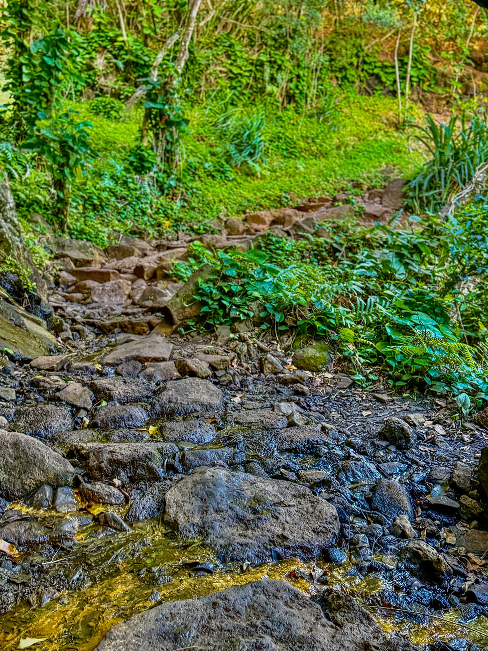
The trail climbs immediately from Keʾe Beach, leaving the coast behind and rising along the cliff face above the Pacific. Within the first half mile the ocean opens below you and the Nā Pali cliffs begin revealing themselves — green, vertical, and stretching northwest as far as you can see. The scale arrives gradually and then all at once.
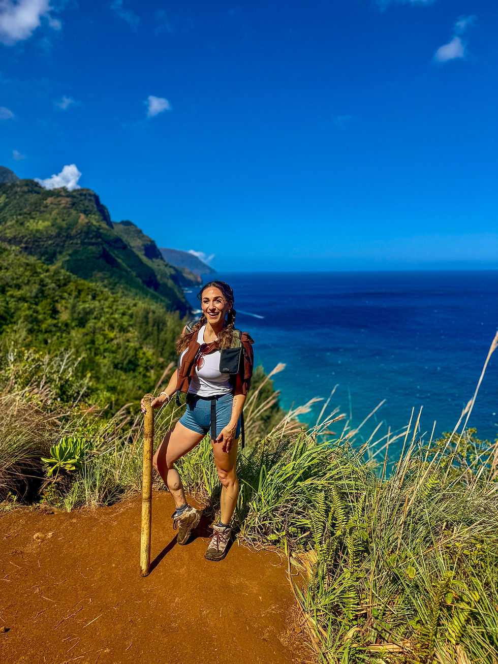
The path runs narrow and rooted along the cliff edge, through dense jungle canopy, over rocks polished smooth by decades of foot traffic. It demands attention. Loose footing on the exposed sections is real — wear proper trail shoes with grip and keep your eyes where your feet are going, not only on the view. The temptation to stop and stare is constant. Build time for it.
What the first two miles give you is Nā Pali from inside it. Not above it, not from a distance — from a narrow path cut into the face of the cliffs themselves. Each turn opens a longer view of the coastline and there is no version of this that feels ordinary.

Mile 2: Hanakapiʻai Beach

The trail descends to Hanakapiʻai Beach at mile 2 — black sand, framed by towering cliffs on both sides, the Hanakapiʻai River meeting the ocean at the far end. Accessible only by this trail. No road, no facilities, no shortcuts.
No swimming. The shore break is deceptive and the currents are dangerously strong year-round. Drownings have occurred here. The ocean at Hanakapiʻai is not the ocean at a resort beach — respect it accordingly.
What the beach gives you is the arrival. The particular feeling of being somewhere that cost something to reach. Sit with it, drink water, eat something, and check in with your body honestly. Only continue to the falls if you have the energy and enough time to get back out before dark.

Miles 2–4: Hanakapiʻai Beach to Hanakapiʻai Falls

From the beach a separate trail cuts away from the coast and into the Hanakapiʻai Valley. The terrain changes immediately and completely. The canopy closes overhead, the path narrows, the ground turns muddy and rooted. The Pacific disappears behind you. What replaces it is jungle quiet — the kind that has weight and texture to it.
Stream crossings begin within the first half mile inland. How many and how challenging depends entirely on recent rainfall. After heavy rain they can become impassable — worth checking recent AllTrails reports the night before you go. On a dry stretch they are manageable with careful footing and good shoes. Trekking poles are optional on the coastal section but earn their place here.
The trail itself is less maintained than the coastal miles — more rooted, more narrow, requiring more active navigation. The valley rewards slowness. Ferns the size of trees line the path. Light filters through the canopy in columns. The sound of water builds steadily as you move deeper in, the falls audible before they’re visible.

Mile 4: Hanakapiʻai Falls

Three hundred feet of waterfall dropping into a clear pool at the back of the valley. It arrives without announcement — the trail rounds a final bend and there it is, filling the entire back wall of the canyon. Cold mist carries across the pool. The sound is total.
No crowd on a weekday. No road that could have brought anyone here. Just the falls, the pool, and the particular stillness of a place that required something to reach. I stayed longer than I planned. Most people do.
Eat. Rest. Take it in completely. This is the turnaround point and the last easy moment before the four miles back.

Miles 4–0: The Trail Out

The return is the same eight miles in reverse and an entirely different experience. Tired legs on exposed cliff edges require the same focus as fresh ones. The views that felt like discovery on the way in feel like confirmation on the way out.
By the time Keʾe Beach appears below the final descent you will have moved through something. The trail asks for your full physical presence for the entire eight miles and in exchange it gives you the specific clarity that only comes from sustained effort in a place this beautiful.
What to Pack
Footwear: Trail runners or hiking shoes with real grip — not sandals, not casual sneakers. The trail is wet, rooted, and uneven throughout.
Water: 2 to 3 liters minimum. There is no potable water on trail. Stream water requires treatment if used as backup.
Food: Pack more than you think you need. A 5 to 6 hour hike burns significant energy.
Trekking poles: Optional for coastal miles, genuinely useful for stream crossings inland, or find a bamboo stick at the beginning of the trailhead (what I ended up doing.)
Rain layer: A light packable jacket takes up almost no space and matters on a wet day on exposed cliff edges.
Sun protection: Sunscreen, a hat, and sunglasses for the exposed coastal miles.
Dry bag or waterproof pack cover: For the stream crossings if you’re carrying a camera.
What to Know Before You Go
Cell service: Fades quickly past the trailhead. Download offline maps and screenshot your gohaena.com permit confirmation before you leave.
Weather: Check the North Shore forecast and recent AllTrails reports the night before, particularly for stream crossing conditions after rain.
Wildlife: Sea turtles are frequently visible from the coastal cliff sections. Nēnē may appear near the trailhead. Both are protected — keep your distance.
Facilities: Restrooms at the trailhead only. Nothing on trail. Plan accordingly.
Turnaround rule: If you reach Hanakapiʻai Beach and don’t have enough water, food, or energy for four more miles, turn around at the beach. The beach alone is worth the hike.
Hāʻena vs. Kokeʻe: Which Side of Nā Pali Is Yours
Hāʻena puts you inside Nā Pali. Kokeʻe puts you above it. They are not competing experiences — they are complementary ones.
Choose Hāʻena if:
• You’re a strong hiker and your permit is secured
• You want to be inside the landscape, not above it
• You need to move through something — where the effort is part of the point
•Eight miles of strenuous terrain is within your current range
Choose Kokeʻe if:
• Permits are sold out or logistics didn’t align
• You want the full aerial context of Nā Pali without the physical commitment
• You’re traveling with mixed fitness levels
• You want a waterfall hike with no permit required
If you have two days: Hike Hāʻena first while your legs are fresh. Do Kokeʻe the following day — standing at Puʻu O Kila Lookout at 4,000 feet the day after you’ve hiked the valley floor below gives the view an entirely different meaning.
Check out the full guide to Kokeʻe State Park, Waimea Canyon, and the Nā Pali lookouts here:
Quick Reference

Park | Hāʻena State Park, Kauai |
Trail | Kalalau Trail to Hanakapiʻai Falls |
Total distance | 8 miles round trip |
Difficulty | Strenuous |
Permit | Required — gohaena.com |
Booking window | Opens 30 days in advance — sells out fast |
Best start time | 7am |
Time needed | 5–6 hours |
Facilities | Restrooms at trailhead only |
Cell service | Limited past trailhead — download offline maps |
Trail conditions | AllTrails — search Kalalau Trail Kauai |
Save This for Your Kauai Trip
Permits for Hāʻena sell out weeks in advance. Save this post now so you have the gohaena.com link, the logistics, and the mile-by-mile breakdown ready when you’re planning.
And if you’re deciding between Hāʻena and Kokeʻe — or trying to fit both into your itinerary — read the companion guide to Kokeʻe State Park and Waimea Canyon next.

Kayla Daquino is the founder of Daquino Destinations and creator of The Becoming Journey™ — a structured solo travel methodology for women navigating major life transitions. Based in California. Perpetually in motion.
Disclaimer: Some of the links on this blog are affiliate links. This means that if you click a link and make a purchase or book a service, we may earn a small commission at no extra cost to you. These commissions help support our work and keep this content free for readers. We only recommend products, services, and experiences we genuinely trust and believe will enhance your travel adventures.

Comments